1. INTRODUCTION
The tectonic location of the Iraqi Kurdistan region [Figure 1] within the extreme northern part of the Arabian Plate and the collision of the Arabian and Eurasian (Iranian) plates has caused the development of different metallic minerals in the region. Moreover, the thrusted parts of the ophiolite from Iran inside the region [Figure 2] include different metallic and radioactive minerals. The existing metallic minerals in the Kurdistan region, however, are not only within the thrusted ophiolite bodies but they are also deposited by hydrothermal fluids in the northern and northeastern parts of the region in Erbil, Duhok and Sulaimaniyah governorates within sedimentary rocks mainly of Jurassic and Cretaceous ages.
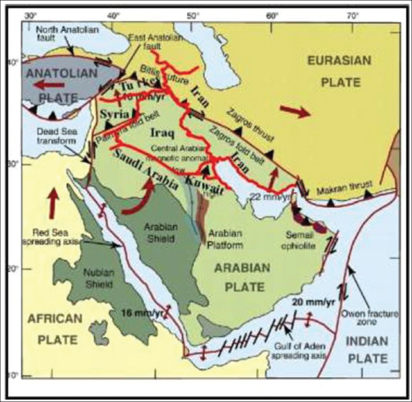
Figure 1. Tectonic location of the Iraqi Kurdistan region within the Arabian Plate and its relation within the neighboring Eurasian Plate (After Johnson, 1998)
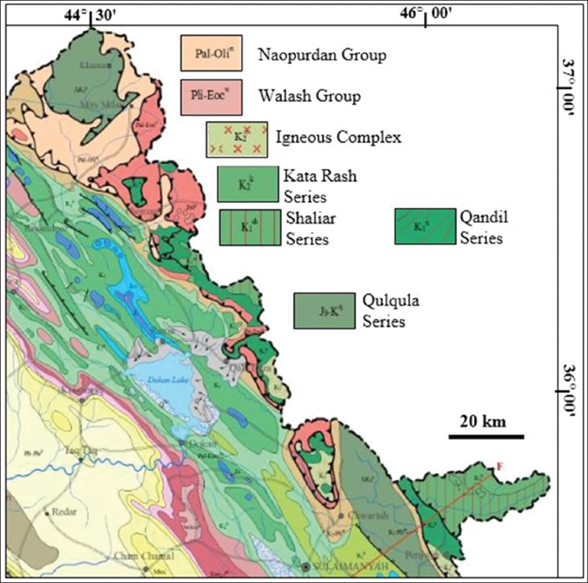
Figure 2. Geological map showing the thrusted ophiolite bodies inside the Kurdistan region (After Sissakian and Fouad, 2012)
The main aim of this work is to collect data about showing and occurrences of the metallic minerals in the Kurdistan region. Moreover, to present a critical review of the metallic and radioactive minerals which are studied in different stages, but none of them has reached the high level of confidence that allows its investment. The existing non-metallic minerals and industrial rocks are out of the scope of this study.
2. MATERIALS AND METHODS
To fulfill the aim of this work, the following materials are used:
-
• Available geological maps and reports in the archive of Iraq Geological Survey (GEOSURV).
-
• Available postgraduate theses which deal with the subject of the current work.
-
• Published articles and internet data which deal with of the current work.
The current work, however, is mainly based on the published articles and reports which are updated by the current author using the best available data hitherto. The main source of the used data is the reports available in GEOSURV’s Library, which represents >60 years of geological exploration in the Kurdistan region. Moreover, many postgraduate theses are used in conducting of the current work.
2.1. Previous Works
Published works which deal with presenting minerals wealth in the Kurdistan region are very rare. Al-Bassam (1984 and 2013) compiled the available data on the minerals wealth in the Kurdistan region. He divided the region into minerogenic zones and presented the existing minerals in each zone. Sissakian (2014) presented the minerals wealth in a special workshop which he arranged in Koya University.
2.2. Mineral Exploration Works
The main carried out mineral exploration works in the Kurdistan region are briefly reviewed to show the size of the carried out works in different parts of the region. Moreover, they indicated the stages of the carried out works.
2.2.1. Site investigation Co. (UK)
In the early 50s of the past century, mineral exploration project was carried out by the Site Investigation Co. (UK). The potential areas in the region were divided into six blocks [Figure 3] each has a serial number (K1–K6) and name. The serial numbers of the blocks refer to Kurdistan series which included geological maps of the region at a scale of 1:100,000 (McCarthy and Hall, 1954, Hall, 1954, Stevenson and Cobbett, 1954, and Bolton, 1954). Tens of metallic mineral showing were reported in reconnaissance surveys, which showed Lead (Pb), Zinc (Zn), Fe, and Cu mineralization in different parts of the region. Moreover, Mo, Ni, and Cr showing were recorded but less common as compared to the first group.
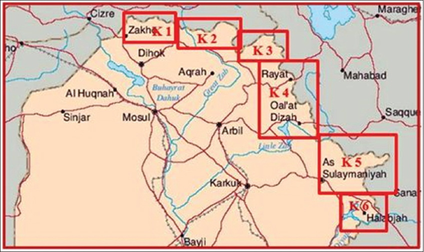
Figure 3. Location map of the six blocks. K 1= Zakho, K 2 = Amadia, K 3 = Merga Sour, K 4 = Qalat Diza, K 5 = Chwarta, and K 6 = Halabja
2.2.2. Ex-Soviet expedition
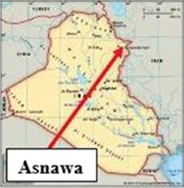
During the early 60s of the past century, a Soviet expedition carried out mineral exploration and investigation in two main areas. In Penjween vicinity for iron at Asnawa village, the ore deposit was found to be of Magnetite (Fe3O4) with subordinate amounts of pyrite, pyrrhotite, chalcopyrite, and arsenopyrite. The reserve estimation was about 100,000 tons only (Teretenko and Khadikov, 1961). They also investigated iron occurrences at Banavi village, NW of Amadiyah. The mineralization is present as fragments and about 2 cm pebbles of galena embedded in screen (Mironov and Sitchenkov, 1962).
2.2.3. Iraq GEOSURV
The main mineral exploration works were carried out by GEOSURV during 1971–2006. However, the exploration works were interrupted many times during the mentioned duration. The Kurdistan region covered by published geological maps at a scale of 1:250,000 and unpublished geological maps at a scale of 1:100,000. Moreover, at many areas detailed geological maps at a scale of 1:20,000 are available for mineral exploration purposes, such as in north and northeast of Zakho until the Greater Zab River (Masin and Saied et al., 1971, Al-Bassam et al., 1982) and Mawat vicinity covering about 250 km2 (Jassim, 1973, Al-Mehaidi, 1974, Al-Hashimi and Al-Mehaidi, 1975).
From the mentioned data, it is clear that the true potential of the minerals wealth in the Kurdistan region is not really known in view of the lack of detailed GEOSURV, mineral exploration and aeromagnetic survey which was performed by CGG (1974). However, the region is promising on the basis of the numerous showing of minerals, the active tectonic nature of the area, and the presence of the thrusted ophiolite bodies inside the region [Figure 2]. It is expected that the Kurdistan region contains more mineral resources which need to be explored and evaluated. The discontinuous nature of the geological works in the past and the lack of airborne surveys and the limited geochemical surveys in this interesting minerogenic province have delayed the accurate estimation of the full potential of the mineral resources in Kurdistan region.
2.3. Metallogenic Zones in the Kurdistan Region
The main mineralization in the Kurdistan region is characterized by endogenic metallic mineralization of Jurassic, Upper Cretaceous, and Paleogene age. It includes mineralization of magmatic, hydrothermal, metamorphic, and sedimentary origin, which may be related to regional orogenic phases. The region is divided into two metallogenic zones on the basis of the tectonic framework and metallogenic features (Al-Bassam, 1984), these are:
-
• Imbricate Zone of the Arabian Plate: The zone is characterized by low-temperature hydrothermal vein and strata-bound, un-metamorphosed Zn, Pb, Cu, and Ba, pyrite and siderite deposits, and placer deposits of Cr, Fe, Mn, and Cu. Two metallogenic districts are recognized here; Ora and Balambo-Tanjero, which are in the meantime well defined tectonic units (Buday and Jassim, 1984).
-
• Zagros Suture Zone: The zone is characterized by magmatic, volcanic, metamorphic, and hydrothermal (associated with magmatism) types of ore minerals. The main phases of mineralization in this zone are of Cretaceous and Paleogene age and are associated with the main igneous activity in the area, which is related to the Laramide orogenic phase.
2.4. Main Metallic Minerals’ Occurrences
Different metallic mineral showing is recognized and reported from different authors. The main occurrences are briefly mentioned hereinafter.
2.4.1. Iron
Iron ore deposits in the Kurdistan region are generally small and are genetically classified into three types (Etabi, 1982): (1) Endogenic contact-metasomatic replacement, (2) magmatic segregation, and (3) sedimentary ironstone. The followings are the main iron occurrences in the region.
2.4.1.1. Asnawa iron ore deposit
This is an iron ore deposit exposed on the surface as a small contact-metasomatic type deposit. It is located about 50 km NE of Sulaimaniyah city. The deposit is within a diorite intrusion penetrating the Upper Cretaceous–Paleocene Qandil series. The iron ore has an irregular shape [Figure 4], the southern part is considered more promising for its larger size and a higher degree of mineralization. It can be traced for 400 m with about 13 m average thickness.
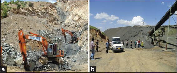
Figure 4. (a) Asnawa iron ore mine, (b) the crushing and sieving plant
The dominant iron minerals are Fe3O4 with subordinate amounts of pyrite, pyrrhotite, chalcopyrite, and arsenopyrite. The average chemical composition was reported by Terentenko and Khadikov (1961) as follows: Total Fe 40.1%, SiO2 24.4%, Al2O3 5.82%, TiO20.1%, and P 0.14%. However, according to a local miner, the concentration of the iron varies from 60 to 80%, whereas the northern part is characterized by poor mineralization with scattered Fe3O4 impregnations. The ore-bearing horizon extends for 500–550 m with an average thickness of about 4 m and average total Fe of about 18%. The Asnawa deposit was investigated by drilling, and the reserves were calculated on categories C1 and C2 by 4 million tons (1.3 million tons of which on category C1).
The deposit is utilized by a local villager; he has mined, crushed, and sieved [Figure 5] about 300,000 tons of Fe3O4 and supplies to the cement plants in Sulaimaniyah. It is worth mentioning that Asnawa iron ore is the only utilized metallic mineral in the Kurdistan region.
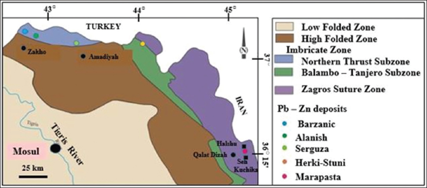
Figure 5. Location of some lead-Zinc mineralization within the tectonic zones of Iraq (Modified from Al-Bassam, 1984)
2.4.1.2. Mishaw iron ore occurrence
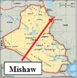
The Mishaw (Mishav) iron ore occurrence is located 38 km NE of Asnawa, within the volcano-sedimentary sequence of Walash Group of Paleogene age. The ore occurrence includes nine zones of Fe3O4 - hematite mineralization located in andesite and tuff horizons of the Shalair Group (Sissakian and Fouad, 2014). The iron-bearing zones are of limited extensions, ranging from 20 to 50 m in length and 4 to 5 m in thickness.
The main three zones are 100–350 m long and 2–18 m thick (Terentenko and Khadikov, 1961). Fe3O4 and hematite are the main minerals, present as segregations of various sizes in nest - like accumulations. The mineralization is complex and of uneven distribution, and the iron zones include large blocks of barren rocks with rare streaks and patches of Fe3O4. The Mishaw iron occurrence was considered as uneconomic due to the small size and low iron content (Chaikin, 1970).
2.4.1.3. Penjwin iron occurrence
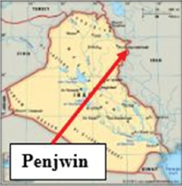
This occurrence is located about 50 km east of Sulaimaniyah city near the Iranian borders. A number of small vein-like and irregular Fe3O4 bodies of magmatic segregation origin were observed in ultrabasic rocks of the Penjwin Intrusive Massif, represented as Igneous Complex on the geological map [Figure 2]. Increased iron concentrations of Fe3O4 type together with chromite were reported to be in the serpentinized peridotites (Buday and Vanecek, 1971). However, no data about the chemical composition and dimensions are available.
2.4.1.5. Banavi iron occurrence
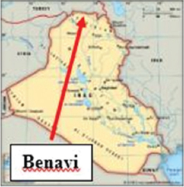
Banavi iron occurrence is located 20 km northwest of Amadiyah town. The occurrence is sedimentary ironstone, which is not common in the Kurdistan region. This is one of a few iron occurrences of this type; it is in the form of an elongated E – W body 2.2 km long and 15–30 m thick within the Jurassic - Cretaceous sequence in the Imbricate zone. The ironstone is composed of oval to elliptical greenish - yellow oolites of iron minerals (limonite, goethite, and hematite) associated with limestone breccia.
The chemical analysis shows in percentage: Fe2O3 (17.8–26.2), CaO (27.4–32.7), SiO2 (4.4–4.94), Al2O3 (2.05–2.49), P (0.21–0.43), and S (0.12–0.21). The geological reserves were estimated by 15–20 m.t. (Geozavod, 1981).
2.4.2. Copper
Copper is one of the most promising minerals in the Kurdistan region. Its occurrences are reported from different parts of the region with different genesis and host rocks. The main promising occurrence is that of Mawat area; other occurrences are less promising. The significant occurrences are described hereinafter.
2.4.2.1. Mawat copper deposit
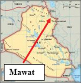
Mawat Copper deposit is the largest promising area with mineral potential in the whole Kurdistan region. Moreover, it is the most studied mineral occurrence with high level of confidence. It covers an area of about 250 km2 with unknown thickness, but not <270 m. It is located north of Sulaimaniyah city. The center of the body is about 32 km north of the city. The copper deposit occurs mainly in gabbroic rocks with many other igneous rocks, which belong to the Intrusive complex and Qandil series surrounded by Walash and Naopurdan Groups; both include sedimentary–igneous rocks [Figure 2].
The mineralization in the Mawat copper deposit consists of chalcopyrite, pyrite, malachite, and azurite, with Cu content between 2.84% and 23% (Smirov and Nelidov, 1962 and Al-Hashimi and Al-Mehaidi, 1975). Iraq GEOSURV carried out detailed geological mapping for the whole Mawat massif during 1972–1974 (Al-Mehaidi, 1974), the mapping was forwarded for mineral exploration, especially for the copper occurrence. Five rock samples systematically arranged were collected from each one square kilometer and subjected for chemical analysis. The maximum copper concentration was found in a sample collected near Waraz village to be 54140 ppm, whereas the minimum was 4000 ppm (Al-Mehaidi, 1974). Moreover, GEOSURV drilled an exploratory borehole near Waraz village during 1990–1991, the drilling terminated at a depth of 270 m with continuous copper showing. The copper mineralization in Mawat copper deposit is of hydrothermal origin (Buday and Vanecek, 1971). The magmatic type is present as disseminated mineralization in mafic and ultramafic rocks, whereas the other type is hydrothermal mineralization, often occurring in quartz veins. The copper horizons are thin, range in thickness from 10–50 cm and extend to 1–5 m. They occupied sheared and fracture zones in metabasalt and greenschist, which are mostly, associated with acidic rocks and quartz veins.
Toma et al. (2017) and Jassim et al. (2017) conducted research works on Mawat copper and called it Mawat Sulfide Ore following Taguchi method for beneficiation of the copper.
2.4.2.2. Other copper showing
Copper showing occurs in different parts of Kurdistan, but all are of small extensions and low concentrations. However, small surface showing may Pb to large subsurface deposit. Some of the showing (Al-Bassam, 1980, 1981 and 1984) are mentioned hereinafter.
-
• Malachite in sandstone and ferruginous dolomitic limestone near Qandil.
-
• Quartz veins with malachite occurring in dolomitic limestone beds of the Qandil series near Sar Merga.
-
• Some occurrences were described in the Qulqula series near Qulqula and near Surgala villages. A grab sample from the latter, mineralized by malachite and azurite, gave 11.8% Cu.
-
• Some traces of copper mineralization were described from serpentines and epidiorites occurring east of Qala Dizeh (Qalladaze) near Delo, Shaikh Awdalan, and Ahmandan villages.
-
• >10 copper showing was reported to occur near Jira village east of Qala Dizeh. They are associated with sericite-chlorite and epidot-schist, cut by some granitic dikes. The mineralization consists of malachite and Cu-bearing pyrite with a concentration of Cu varying from 0.1 to 3.4%.
-
• A copper mineralization at Bir Achminda-Benoza, related to the Bulfat Massif, consists of chalcocite, chrysocolla, malachite, limonite, and quartz in sericite schists of the Walash Formation.
-
• In Mawat area, chalcopyrite, pyrite, and malachite occur near Mirawa village.
-
• Quartz veins with chalcocite, chalcopyrite, pyrite, and malachite occur near Kurra Dawi village. One of the samples described as gray epidiorite contained 7.8% CuO, 72.5% Fe2O3, and 0.6 g/ton Au (Williams, 1948).
-
• Many copper showing is known from a crushed zone in gabbro SW of Kurra Dawi village and granodiorites, pyroxenite, and gabbro south of Konjirin Village. The mineralization consists of chalcopyrite, pyrite, malachite and azurite, with Cu content between 2.84% and 23% (Smirov and Nelidov, 1962, Al-Hashimi and Al-Mehaidi, 1975).
-
• A mineralization zone, few 100 m long and 35 m wide, occur near Waraz village. It is formed by chloritic schists containing malachite, pyrite, and quartz. Webber (1952) reported a thickness of about 4 m and an average content of Cu of 0.2%. A grab sample containing 37.1% Cu was described from this locality by Smirov and Nelidov (1962) and of 100,000 ppm by Ali et al. (2012).
-
• Some copper showing in the Walash Group in Shalair Valley was reported near Mishav and Abdalan villages.
2.4.3. Zn and Pb
Geological exploration for Zn and Pb has started in the 70s of the past century by GEOSURV geologists. They found two main potential areas of Zn-Pb occurrences. The first is in Marapasta; east of Qala Dizeh town and the second in Serguza, northwest of Amadiya town [Figure 5]. In both localities, detailed work was carried out including drilling and geophysical prospecting. In 1980, Yugoslav Geozavod Institute carried out exploration in the first locality. In 1990–1991, GEOSURV renewed its activity in Marapasta. Accordingly, there are two main Zn-Pb deposits which have reserve estimation after they were partly explored in some details relative to the other Zn-Pb occurrences and can be considered as the high level of confidence.
In addition, there are about 10 other Zn-Pb occurrences distributed mostly in the Northern Thrust Zone, within carbonate rocks of Mesozoic age, such as Barzanic, Alanish, Serguza, and Harki-Stuni [Figure 5]. These occurrences, however, are not studied in detail yet, and hence no conclusive evaluation can be made on their potentiality. The author would like to mention that such showing may Pb to discover large deposits if well studied.
2.4.3.1. Marapasta Zn-Pb deposit
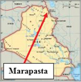
The Marapasta deposit is the most significant and promising Zn-Pb deposit in the Kurdistan region. It is situated about 1.5 km from the Iraqi Iranian borders, about 6 km behind the thrust front and about 36 km NE of Qala Dizeh town, at an altitude ranging from 2,000 to 2,400 m (a.s.l.) near Halshu village. It can be considered as a deposit due to its high level of confidence due to a lot of drillings and chemical analyzes of the collected rock samples and extracted cores from the drilled boreholes.
The Marapasta ore deposit is present within the Qandil series [Figure 2] as small scattered occurrences of complicated and irregular shapes, concentrated in three main localities: Seh Kuchika (2410 m; a.s.l.), Darman, which is about 800 m NW of Seh Kuchika, and Natra which is about 1000 m east of Seh Kuchika (Bolton, 1956). Other minor showing of the minerals is scattered irregularly in the area (Akif et al., 1973 and Masin et al., 1971).
The chemical analysis of few samples have shown that the ore is rich in Cd (Cd/Zn about 1/1000), in As (>3%), in Ni, especially where the spinel minerals and Fe3O4 are present, and low in Ag due to the low content of Galena in the ore (Akif et al., 1973). Isotopic dating of galena showed an age range of 180–200 Ma, which is Triassic–Late Jurassic (Hak et al., 1983).
The whole Marapasta area was covered by geophysical and geochemical exploration (Masin et al., 1971, Nahab and Rahman 1974, and Al-Bassam, 1972), but the exploration by drilling was concentrated at the Seh Kuchika area only (Akif et al., 1973 and Akif and Mustafa, 1974). The drilling in Seh Kuchika has shown that the ore body has subsurface extension, of the same dip and strike as the enclosing limestone beds and was continuous down to 42 m depth. Other ore bodies at Seh Kuchika have the same trend, but drilling was terminated at 42 m, due to the drilling capability, which means the ore is deeper than 42 m. To estimate the ore reserves in Marapasta, Akif and Mustafa (1974) drilled 20 boreholes and dug many trenches. The Zn and Pb reserves are 100,520 tons and 18,117 tons, respectively.
2.4.3.2. Serguza Zn-Pb deposit
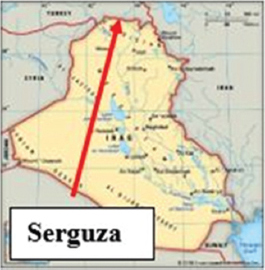
The Serguza deposit is the second Zn-Pb ore in importance after Marapasta in the whole Kurdistan region. It is located 17 km NW of Amadia [Figure 5]. The deposit area is built of Middle and Late Triassic limestone and dolomite beds. The oxidized ore in Serguza extends for an area of about 3 km². The main part of the sulfide ore body is situated at the tectonic contact between the Tertiary and Triassic rock units [Figure. 5].
The ore emplacements, defined as Zn and Pb concentrations in pyrite or goethite limonite bodies, are located in the dolomitic limestone of the Middle-Late Triassic age of the Kurra Chine Formation. Three ore bodies were recognized in the area; western, northern, and southeastern. The western ore body extends partly along the Triassic–Miocene tectonic contact for about 130 m, the ore-bearing horizon is 5–10 m thick, 350 m long, and 200 m wide. The northern ore body is highly oxidized, extends for about 200 m in outcrop, 150 m wide, and about 5 m in thickness. The southern ore body can be traced in outcrops for about 300 m and is about 60 m wide with an average thickness of 6.3 m. The reserves were estimated (Geozavod, 1981) on two categories: C1, 1,971,000 tons of ore containing metal reserves and 42,968 tons of Zn and 36,069 tons of Pb. The C2 reserves were estimated as 37,000 tons Zn and 31,000 tons Pb (Al-Bassam, 2013).
2.4.3.3. Berzanik Zn-Pb occurrence
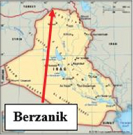
The Berzanik Zn–-Pb occurrence is located 25 km north of Zakho, in a rough mountainous area [Figure 5], it is dominated by sedimentary rocks of Triassic and Jurassic ages. Three marked outcrops of gossan and barite occur along the main thrust fault, which separates the Triassic from the Permian rocks. They are up to 75 m long and 3 m wide. Sphalerite, Galena, smithsonite, and barite were recorded, they occur mostly in the screen and crushed rocks of the Triassic rocks.
The chemical analysis of three samples showed 36.5% Zn, 2.1% Pb, and 0.3% Cd and up to 50.6% Ba (McCarthy and Smit, 1954). In 1980, GEOSURV covered the area by geochemical soil exploration to explore the occurrences, which still lack subsurface data and geophysical exploration. Several important geochemical anomalies of Pb and Zn were identified, most of which coincide with the contact zone between Triassic and older rocks (Al-Bassam, 1981 and Al-Ka’aby and Al-Azzawi, 1991).
2.4.3.4. Alanish Zn-Pb occurrence
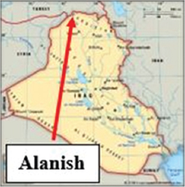
The Alanish Zn-Pb occurrence is located 24 km NE of Zakho and about 6 km SE of the Berzanik occurrence [Figure 5] A vein of dark brown iron-rich gossan was found associated with barite and dolomite. The length of the exposure is about 600 m and is 3–5 m wide. A second mineralized outcrop was found parallel and eastward of the first one; it extends for 150 m and is 3 m wide. Two other exposures on the same trend were also found, 100 m long each and about 2 m wide. McCarthy and Smit (1954) considered the Alanish occurrence the most extensive in the area NE of Zakho.
2.4.3.5. Other Pb-Zn anomalies
Many other Pb-Zn occurrences were reported from different parts of the Kurdistan region. The main occurrences are mentioned hereinafter (Al-Bassam, 1984 and 2013).
-
• Patruma–Marsis Pb Occurrence: It is located 23 km NE of Zakho. The mineralization extends for 5 km, coinciding with the WNW – ESE thrust fault.
-
• Banik Pb Occurrences: It is located about 28 km ENE of Zakho. The mineralization is oxidized, associated with barite, which extends for a distance of 60 m and an average width of 10 m. Visible blebs of galena were noticed in the gossan and the barite (McCarthy and Smit, 1954).
-
• Lefan Zn-Pb Occurrence: It is located about 21 km NE of Zakho. A shallow depression occurs showing an old mining site. It is rich in Galena, sphalerite, and barite. Irregular veins of siderite and limonitic gossan were found near the crest of a ridge above Lefan, in the limestone beds of the Qamchuqa Formation.
-
• Qala Dizeh area: Three anomalies were identified about 10 km NE of Qala Dizeh town, which showed 525 ppm Pb, 456 ppm Cu, 20 ppm Mo, and 16 ppm Ag.
-
• Mishav area: This is located in the extreme eastern part of Shalair valley. Three promising showing occurs with an average content of Pb, As, and Cu in the fine fraction reached 718 ppm, 343 ppm, and 447 ppm, respectively.
-
• Penjwin area: Four anomalies were found with 786 ppm Pb, 567 ppm Cu, 355 ppm As, and 18 ppm Ag.
-
• Banavi Pb Occurrence: It is located 10 km west of the Serguza Zn-Pb deposit. The mineralization is present as fragments and pebbles of galena embedded in screen.
-
• Ora Pb Occurrence: It is located about 6 km from Ora village. A small fracture was reported by Pavel (1955), and ancient mining works were suggested by the much waste rocks and a 20 m long tunnel in a mineralized zone. The mineralization occurs within bedded quartzite, sandstone, and limestone. Blebs of galena were noticed together with malachite,, and chalcocite.
-
• Herki Pb Occurrence: It is located about 2.5 km south of Herki village. A zone of limonitic gossan 90 m long, indicates a vein-type deposit including Ggalena and residual blebs of pyrite.
2.4.4. Chromium and nickel
All known Cr and Ni occurrences of Kurdistan region are connected with intrusions of ultrabasic rocks, which are in many cases serpentinized. Association of Cr and Ni mineralization’s were reported in two main districts of the NE Nappe Zone (Tectonic Imbricate Zone), which is a zone of magmatic, skarn, hydrothermal, and volcanogenic-hydrothermal deposits). These are in Penjwin area and Rawanduz area (Buday and Vanecek, 1971). The main occurrences are briefed hereinafter.
-
• At Shetna-Sheikhan locality in Rawanduz; the limestone beds are intruded by basic and ultrabasic rocks altered into serpentines. Six small chromite lenses were reported occurring together with Fe3O4. They contain (50–51)% Cr2O3, (14.5–15.8)% FeO, 0.13% TiO2, and 0.14% Ni (Polnikov and Nikolayev, 1962).
-
• In Penjwin vicinity, near Boban, >20 chromite bodies are exposed. Their thicknesses vary between 0.2 and 0.5 m and their lengths from 5 to 15 m. Teretenko and Khadikov (1961) distinguished two types of chromite bodies: A massive variety containing 41.6–52.2% Cr2O3 and 9.0–14.9% FeO, and an impregnated variety with about 31.6% Cr2O3 and 11.0–15.3% FeO. Platinum content in these occurrences is about 30 ppm. The biggest of chromite bodies was estimated to contain about 9000 tons of chromite (Teretenko and Khadikov, 1961).
-
• Near Rayat, there are two Cr-Ni mineral showing. Five bodies of chromite and Fe3O4 lenses occur in the Walash Group in Bardi Zard area. Average content of these bodies is 39.24% Cr2O3 with Cr2O3/FeO ratio of 2:7. The size of these chromite bodies varies between 1.5 × 0.2 m and 2.5 × 0.4 m. Nine places were reported to contain small veins; 1–5 m long and few centimeters thick, containing niccolite, rammelsbergite, arsenopyrite, pyrite, carbonates, and secondary nickel minerals. The Ni content varies between 0.3 and 4.38% averaging 1.45% Ni and 0.01% Co.
-
• At Darband in Rawanduz area, another locality of Cr-Ni mineralization is located. The area is built by volcanic and calcareous argillites and serpentinites. Fe3O4 and hematite occur in a crushed zone. This mineralization occurs in three zones where eight small bodies are known. The iron mineralization is accompanied by about 4% Cr2O3, 0.5% Ni, and up to 1% Cu and about 0.02% Co.
-
• At Galala area, in Rawanduz vicinity, Nickel and copper association is known in the serpentinite bodies which is exposed for about 8 km. Few collected samples showed an average of 0.2–0.3% Ni and 0.5% Cu.
-
• At Kani Manga village, six chromite lenses were reported. The lenses are 0.3–0.5 m thick and 5–10 m long. The Cr content ranges from 30–35% Cr2O3 to 10–13% FeO.
-
• At Kani Gable, southeast of Penjwin, more than 10 chromite bodies occur in an area of about 1.5 km2. Their average thickness is about 0.8 m with maximum contents of 52.2% Cr2O3 and 15.3% FeO. Two of the bodies extend to about 70 m.
2.4.5. Manganese
Manganese occurrences in Kurdistan region are mostly related to the Qulqula series (Upper Jurassic–Middle Cretaceous). They occur in Penjwin vicinity and northeast of Rania. Their origin is not clear, but since they are exposed within siliceous rocks of the Qulqula series, then they are believed to be of volcanic-sedimentary origin (Buday and Suk, 1978). The mineralization consists of manganese oxides and hydroxides, such as psilomelane, pyrolusite, manganite, and some limonite. Two of the main Mn occurrences were reported by Buday and Vanecek (1971). They are briefed hereinafter.
-
• At Gola village northwest of Penjwin, volcanogenic-sedimentary Mn occurrence was reported. The mineralization is related to a basaltic intrusion into chert-clay slates of the Qulqula series (Smirov and Nelidov, 1962). The Mn content in this occurrence is 34.05% with 10.2% Fe.
-
• Near Kani Saiph village south of Penjwin, manganese mineralization occurs in a crushed zone within the shales of the Qulqula series. The mineralized crushed zone is 80–100 m thick and about 1 km long. Films, streaks, and nests of manganese minerals such as psilomelane, pyrolusite, and manganite associated with limonite were reported.
2.4.6. Radioactive minerals
Geochemical and foot-born radiometric surveys at selected areas in the Kurdistan region showed very interesting anomalies of uranium and thorium. These anomalies are mostly related to igneous and metamorphic rocks of Qandil and Walash series, as well as to black shales of Naokelekan and Barsarin Formations of Jurassic age. The following occurrences are reported (Al-Bassam, 1984 and 2013).
-
• Penjwin Vicinity: Geological and radiometric surveys were carried out in the Shalair Valley east of Penjwin town in several locations where granitic intrusions were found, at Weena, Darukhan, Awlan, Mishau, and South Laladar villages. The country rocks are dominated by the Qandil series (Cretaceous) and the Walash Group (Paleogene), high radiation was noticed near and around the granitic bodies (Al-Shible and Kettaneh, 1972).
-
• Qala Dizeh: Several areas near Qala Dizeh showed anomalous radiation and high uranium and/or thorium concentrations within rocks of the Qandil series.
-
• In Shaikh Rasht Mountain up to 3500 cps was recorded in pegmatite veins. Selected mineralized samples showed 9.7% Th and 0.35% U.
-
• In Geli Kubi Mountain (Perus Peak; 2134 m) up to 700 cps was recorded in the serpentines with 860 ppm Th and 3.2–4.2 ppm U.
-
• In Dwaiza Mountain, 5.5 km NE of Hero village up to 2700 cps was recorded in the olivine with 210–830 ppm U.
-
• In Kani Muesh (1 km NE of Belko village), up to 3000 cps was recorded, with 67–222 ppm U and 50–630 ppm Th in the biotite syenite.
-
• In Nisi valley, 3.5 km NE of Hero up to 1200 cps was recorded, with 650–1590 ppm U and 3140–10,170 ppm Th in the olivines.
-
• Rawanduz–Galala–Rayat: Radiometric surveys in this area covered the Jurassic black shales of the Naokelekan and Barsarin formations. The radiation was in the range of 200–400 cps and up to 56 ppm U was recorded in the black shales (Al-Kazzaz, et al., 1972).
-
• Duhok Governorate: In 2006, Iraq GEOSURV performed a radiometric survey at Banik area within the black shales of Jurassic age. The results were not courageous.
3. DISCUSSION
The geological position of the Kurdistan region, as the collision of tectonic plates and its consequences is concerned, and the presence of thrusted parts of the main ophiolite that extends from Cyprus–Turkey–Iran–Oman inside the northeastern part of the region allows large possibilities for existing different metallic minerals. Moreover, the hydrothermal fluids have deposited different metallic minerals in different sedimentary rocks mainly of Cretaceous age. The same geological conditions have contributed to the deposition of uranium and thorium in different igneous and sedimentary rocks in the region.
The discovery of Late Cretaceous arc volcanism in the northeastern part of the Kurdistan region reveals an as yet unidentified episode of Late Cretaceous, Neo-Tethyan ophiolite-arc complex in the Iraqi Zagros Thrust Zone that may well represent lateral equivalents of the ophiolite-arc sequences in Oman–Neyriz, and Cyprus. The petrography and mineral chemistry of albite forms the main composition of the subhedral laths and microlites in the matrix, but primary oligoclase (An27), is also observed. Iron oxides are mostly ilmenite, Fe3O4, and hemato Fe3O4, while apatite, sphene, and zircon occur as accessory minerals (Ali et al., 2012).
Arc spatial-chemical relationships indicate magmatic evolution of a calc-alkaline, island-arc suite with low-K characteristics in the thrusted ophiolite bodies inside Kurdistan region; including the igneous body on the top of Hassan Beg Mountain; north of Soran town. It is worth mentioning that all existing geological maps show that the igneous rocks of Hassan Beg belong to the Walash Group. The subduction signature of volcanic and sub-volcanic rocks is confirmed indicating arc-related rocks. The mantle source had considerable subduction influence, and the resulting magmas were affected by significant contamination of lithospheric material from the pre-existing crustal component. They are generated from the mantle wedge within a supra-subduction zone setting and are influenced by slab-derived components. The igneous rocks show similar geochemical trends to arc rocks from Neyriz in southwestern Iran. Therefore, we can believe that the rocks are remnant of Late Cretaceous ophiolite/arc rocks that developed within the Neo-Tethys Ocean and were subsequently accreted to the Arabian Plate during the Late Cretaceous to Paleocene (Ali et al., 2012). The author is in accordance with Ali et al. (2012) and believes that great possibility occurs for the existence of different mineralization zones within the thrusted ophiolite bodies since they are developed within the Neo-Tethys Ocean and were subsequently accreted to the Arabian Plate. It is worth mentioning that the same ophiolite bodies in Iran include different types of metallic minerals which are mined.
The tectonic model of Ali et al. (2012) proposed opening of the Neo-Tethys and separation of the Sanandaj–Sirjan microplate from the Arabian Plate in the Permian to Triassic. During the Early Cretaceous a supra-subduction zone ophiolite/arc complex, including Hasan Beg rocks (106-92 Ma), developed in the Neo-Tethys Ocean and was subsequently abducted onto the Arabian Plate margin during the Late Cretaceous to Paleocene. This collision initiated a new intra-oceanic subduction system in the Neo-Tethyan Ocean. This is a good indication for the presence of different types of metallic minerals within the thrusted ophiolite bodies inside the Kurdistan region.
A generalized map presenting the main minerals showing in the Kurdistan region is given in Figure 6. It is clear that the showing is concentrated on the northeastern part of Kurdistan, which tectonically represents Zagros Suture Zone and Shalair Serjan – Sanandaj Terrain (Fouad, 2012). Moreover, there is another concentration of minerals showing in the northern part of the region which tectonically represents part of the Imbricate zone with a major and main thrust (Fouad, 2012), which has contributed in the movement of the hydrothermal fluids and depositing of strata band type deposits.
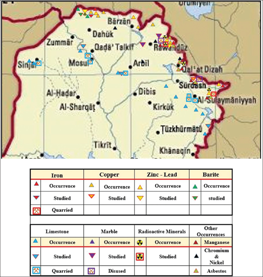
Figure 6. Generalized location map of the main mineral showing in the Kurdistan Region
The existing mineral occurrences in the Kurdistan Region are discussed with emphasizing on their significance in evaluating the mineral s wealth in the region.
3.1. Copper
From the presented data in the current study, it is clear that the most metallic mineral that shows high potential is the copper. The already carried out works by Iraq GEOSURV in Mawat Massif north of Sulaimaniyah city for investigation of copper included detailed geological mapping, chemical analyzes of the collected samples and drilling. All the acquired results which are of the high level of confidence confirm the presence of very high potential of copper. The thickness of the gabbroic rocks which include the copper is unknown but is >270 m. This is confirmed by the depth of the drilled borehole by GEOSURV near Waraz village, the southern part of Mawat Massif. The extracted core shows an indication for the presence of the copper continuously through the drilled borehole. The coverage area of the massif is about 250 km2. The exposed rocks are almost without any overburden; apart from very thin residual soils in some parts of the massif [Figure 7].
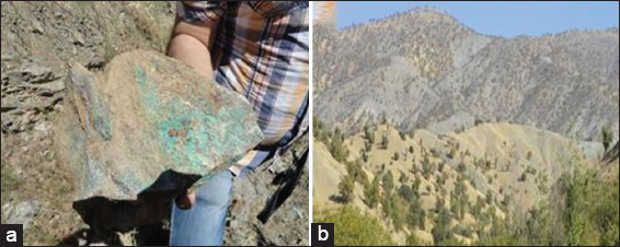
Figure 7. (a) A surface sample with malachite stains, (b) General landscape in Mawat Massif; note the absence of overburden on the exposed gabbroic rocks.
The recorded concentration of the copper in the analyzed samples (about 800) ranges from 4000 to 54140 ppm, in Mawat Massif, which covers about 250 km2. However, Ali (2016) detected the concentration of 100,000 ppm from a surface collected sample. The main mineralization is of hydrothermal type, and the main minerals are chalcopyrite, malachite, and native copper.
All these data make the Mawat Massif a very promising area for copper exploration with a high level of confidence. Thus, it is the most significant mineral potential in the Kurdistan region.
3.2. Zn-Pb
The potential of Zn-Pb occurrences is very encouraging in the Kurdistan region with many significant indications in both studied sites: Marapasta and Serguza. Marapasta is in direct contact with the ophiolite bodies which are originated from the mantle (Ali et al., 2012). The hydrothermal fluids deposited different metallic minerals with different concentrations, among them are Mawat Massif with copper and chromite (Mirza, 2008) and the Marapasta deposit. Although the Serguza deposit is very far from the existing ophiolite bodies, it is within the main thrusted rock units in which again the hydrothermal fluids have deposited different metallic minerals.
The carried out exploration by GEOSURV in the two mentioned deposits still needs detailed exploration including drilling of deep boreholes, geophysical traversing, geochemical survey, and remote sensing applications. However, the bulk of the carried out work can be accepted as medium level of confidence.
3.3. Iron
The most promising iron deposit which can be considered as ore is the Asnawa deposit [Figure 3]. In Kurdish vocabulary, Asnawa means a place where iron is rich in the area (Kafoor, 2018). The estimated reserve is 4 million tons (Smirov and Nelidov, 1962), and parts of the ore have 60–80% Fe, which means high grade. Although the reserve was estimated by drilling, geophysical exploration, geochemical survey, remote sensing, and geographical information systems techniques will enhance the reserve estimation. This deposit is the only mined one in the Kurdistan region; moreover, it is the only one which can be considered as the high level of confidence due to the carried out investigations and existing mining activity. The second promising deposit of Iron is that of Banavi where GEOSURV carried out investigation during the early seventies of the past century. The results are encouraging and can be considered as of medium level of confidence.
3.4. Radioactive Minerals
Uranium and thorium are the two discovered radioactive minerals in the Kurdistan region, especially in Sulaimaniyah Governorate. The performed radiometric survey by ex-Iraqi Atomic Energy Commission during 70s of the past century showed high anomalies in some granitic rocks of Shalair Series and Walash Group [Figure 2] and black shales of the Late Jurassic age.
4. CONCLUSIONS
From the current presented data, the following can be concluded:
The Kurdistan region is rich in numerous showing, occurrences, and some deposits of metallic and radioactive minerals, the non-metallic minerals and industrial rocks are excluded from this review. However, only the Cu, Zn-Pb, and Fe of Banavi can be considered as the medium level of confidence, and only the iron deposit of Asnawa can be considered as an ore with high level of confidence. Uranium and thorium are recorded in some granitic rocks of Shalair Series and Walash Group, besides black shales of the Late Jurassic age.
The minerals wealth in the Kurdistan region; as a whole cannot be evaluated, hitherto due to lack of detailed geological maps, geochemical surveys, and airborne gravimetric, magnetometric, and radiometric surveys. However, the existing data about the minerals are very courageous in different parts of the Kurdistan region and can be considered as a very high potential area for minerals investigation.
5. RECOMMENDATIONS
To have true and precise evaluation of the minerals wealth in the Kurdistan region, the following is highly recommended:
To start detailed geological mapping including drilling; accompanied with geochemical and geophysical surveys in the most promising areas, especially in Mawat, Marapasta, Serguza, and Banavi. This will facilitate a better understanding of the genesis; accordingly, the modeling for each of the mentioned minerals can be known. The mentioned sites which show uranium and thorium anomalies should be studied in details; including drilling and radiometric survey, besides detailed geological mapping to indicate the extensions of those anomalous rock units.